Grands Communaux wind farm project · Côte-d’Or · Ouche valley

See the Grands Communaux wind turbines before they exist

Today’s decisions, tomorrow’s landscape

This site uses advanced visualisation software to show, as close as possible to a future reality, the potential visual impact of the Grands Communaux wind farm on the communes around Antheuil and Saint-Jean-de-Bœuf, from Sainte-Marie-sur-Ouche in the north to Colombier in the south.

Text to comePlaceholder for the new paragraph.
Turbines simulated
13 T1–T13
Height to blade tip
180 m
Video montages
87
Images
119 photomontages, maps
Places studied
23
Field of view
47 ° (human vision)

Interactive map

Choose a viewpoint

Each dot groups the views taken from one place. Hover over it to see how many videos and images there are, and click to open the page.

AgencourtAgeyAntheuilArcenantArceyAubaineAubigny-lès-SombernonAuxantBarbirey-sur-OucheBessey-en-ChaumeBessey-la-CourBévyBligny-sur-OucheBoncourt-le-BoisBouheyBouillandBrochonLa Bussière-sur-OucheChambœufChambolle-MusignyChâteauneufChaudenay-la-VilleChaudenay-le-ChâteauChauxChenôveChevannesCivry-en-MontagneValforêtCollonges-lès-BévyColombierComblanchienCommarinCorcelles-les-MontsCoucheyCréanceyCrugeyCurleyCurtil-VergyDétain-et-BruantÉchannayÉchevronneL'Étang-VergyFixinFlagey-EchézeauxFlavignerotFleurey-sur-OucheFusseyGergueilGevrey-ChambertinGilly-lès-CîteauxGissey-sur-OucheGrenant-lès-SombernonGrosbois-en-MontagneMagny-lès-VillersMâlainMarey-lès-FusseyMarsannay-la-CôteMesmontMessangesMeuilleyMontoillotMorey-Saint-DenisNuits-Saint-GeorgesPainblancPrâlonPremeaux-PrisseyQuinceyRemilly-en-MontagneReulle-VergyRouvres-sous-MeillySaint-AnthotSaint-Jean-de-BœufSainte-Marie-sur-OucheSainte-SabineSaint-Victor-sur-OucheSegroisSemareySemezangesSombernonTernantThorey-sur-OucheUrcyVandenesse-en-AuxoisVeillyVelars-sur-OucheVeuvey-sur-OucheVic-des-PrésVieilmoulinVillars-FontaineVillers-la-FayeVosne-RomanéeVougeot2 km5 km10 kmThe OucheBurgundy CanalA38A6Dijon 12 km →T1 · 47.21960, 4.78787T2 · 47.21630, 4.78702T3 · 47.21276, 4.78405T4 · 47.20950, 4.78005T5 · 47.20594, 4.77646T6 · 47.20260, 4.77447T7 · 47.19925, 4.77251T8 · 47.19607, 4.76982T9 · 47.19725, 4.75259T10 · 47.19408, 4.75321T11 · 47.19113, 4.75413T12 · 47.18793, 4.75424T13 · 47.18516, 4.756245 kmNAntheuilSaint-Jean-de-BœufFerme de RolleVeuvey-sur-OucheGergueilDétain-et-BruantAbbaye de la BussièreBurgundy CanalLa Bussière-sur-OucheSaint-Victor-sur-OuchePoisotBarbirey-sur-OucheLa PourrieGissey-sur-OucheColombierThorey-sur-OucheAgeySainte-Marie-sur-OucheChâteauneufBouillandChaudenay-le-ChâteauChambœuf, Curley, VergyBrochon (west)
Commune with a pageProject turbineThe OucheBurgundy CanalBase maps: IGN Admin Express (geo.api.gouv.fr), © OpenStreetMap contributors

Video montage · 47° field of view

La Belle Emilia, Saint-Jean-de-Bœuf

With the EnergyPlanner software, the project can be shown at different times of day and night and in different wind conditions, in still photomontages and in videos.

For technical information on how these images were made, see the method.
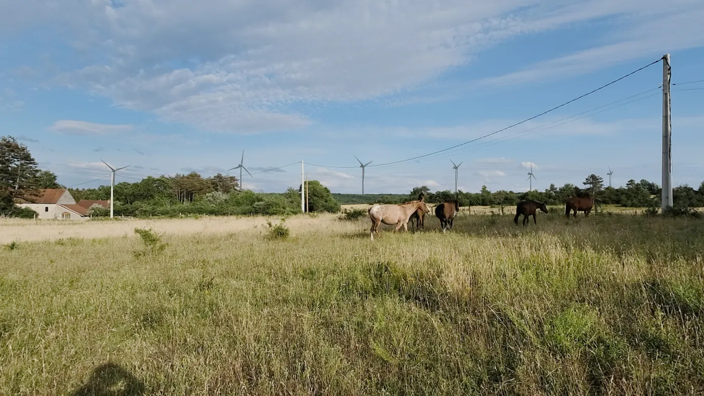
All the views from Saint-Jean-de-Bœuf

Photomontage: turbines T3 to T8 above the pastures of La Belle Emilia, Saint-Jean-de-Bœuf. Click to play the video.Play the video · La Belle Emilia (L 05)

What you would see from here

One 180 m turbine, seen from 1 km

This is how tall one turbine would look from this distance, next to buildings you know. Everything is shown at the same distance from you, so you can compare the heights directly.

One turbine is as tall as six 30 m church towers stacked on top of each other.

On a screen, the picture is smaller than real life. To judge for yourself, hold your fist up against the horizon.

How we calculated this

Apparent height is the vertical angle an object takes up in your field of view. At 1 km: house 0.5°, church tower 1.7°, turbine 10.2°. The photomontages on this site are 47° wide. Terrain, light, season and blade movement change what you actually perceive.

Write to Contexte-Visuel

Your details are only used to reply to you. Privacy

Click the photo to zoom